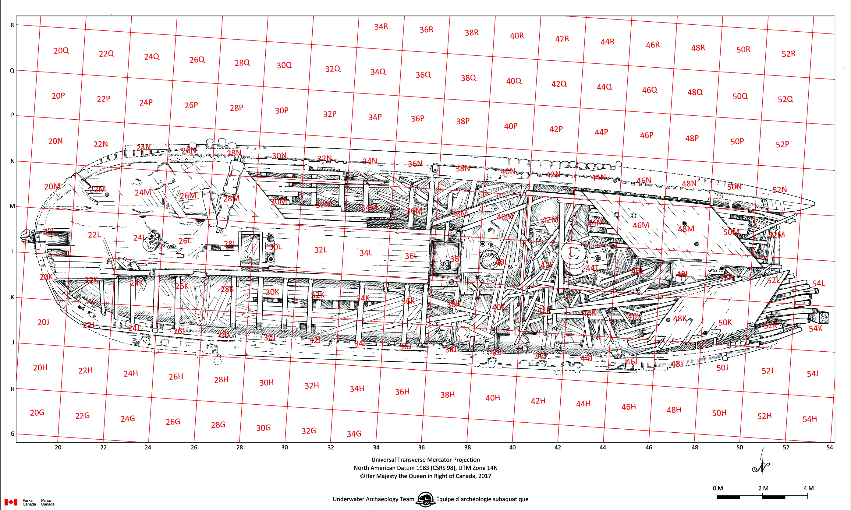
Soubor:Hms-erebus-grid-2017.png
From Franklinova expedice
Size of this preview: 800 × 480 pixels. Other resolution: 2,793 × 1,675 pixels.
Original file (2,793 × 1,675 pixels, file size: 2.56 MB, MIME type: image/png)
Popis
Zaměřovací síť bodů pro archeologický výzkum vraku HMS Erebus, vytyčená archeology Parks Canada. Stav k roku 2017.
Autor: B. Lockhart, Parks Canada; Kresba: C. Pillar, Parks Canada.
Licence
Tento soubor byl vytvořen Parks Canada a autorská práva k tomuto souboru spravuje kanadská vláda. Podrobnosti viz https://www.pc.gc.ca/en/termes-terms#p05
File history
Click on a date/time to view the file as it appeared at that time.
| Date/Time | Thumbnail | Dimensions | User | Comment | |
|---|---|---|---|---|---|
| current | 18:14, 17 October 2025 | | 2,793 × 1,675 (2.56 MB) | Radouch (talk | contribs) | Zaměřovací síť bodů pro archeologický výzkum vraku HMS Erebus, vytyčená archeology Parks Canada. Autor: B. Lockhart, Parks Canada; Kresba: C. Pillar, Parks Canada. |
You cannot overwrite this file.
File usage
The following page uses this file: